Skip to content

TruePravda

Quality interweb mischief from Jared Bridges

  • Home
  • About
  • Colophon
  • Archives
  • Contact

For The Cartophile In All Of Us…

10 January 2005 by Jared Bridges

1861 Map of Tennessee and Kentucky (Library of Congress)

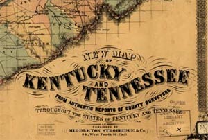
The Library of Congress has released on the internet thousands of maps from the Civil War period. The website, located here, contains battle maps and other general maps from the time. If you live in a state where the Civil War raged, check it out to see what your area looked like 150 years ago.

Categories Miscellaney
The New Age of Adulthood
Wanna Be Lazy? Call It A Boycott
© 2025 TruePravda • Built with GeneratePress